Phys.org August 31, 2023
Researchers in Australia used a digital soil mapping framework to combine data from recent geochemical surveys and environmental covariates that affect soil formation to predict and map aqua-regia-extractable Li content across the 7.6×10⁶ km2 area of Australia. Catchment outlet sediment samples were collected with both top (0–10 cm depth) and bottom (on average ∼60–80 cm depth). They developed 50 bootstrap models using a cubist regression tree algorithm for each depth. The spatial prediction models were validated on an independent Northern Australia Geochemical Survey dataset, showing a good prediction for the top depth. The model for the bottom depth is yet to be validated. The models indicated that the first three Landsat red, green, blue and gamma radiometric dose had a strong impact on the development of regression-based Li prediction. The models were used to generate digital soil Li prediction maps for both depths. The predicted maps showed high Li concentration around existing mines and other potentially anomalous Li areas that had yet to be verified. The same mapping principles could potentially be applied to other elements… read more. Open Access TECHNICAL ARTICLE
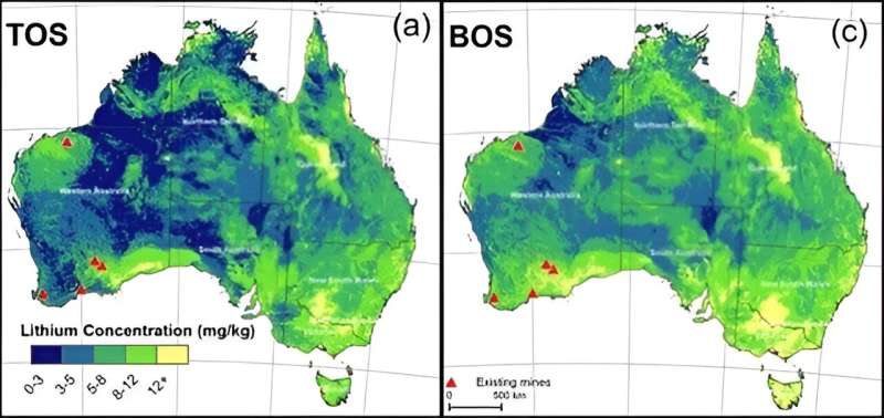
Map showing predicted lithium concentrations in upper sediment…Credit: Earth System Science Data (2023)