Science Daily November 1, 2021
New satellites are opening a new window into tectonic processes by allowing researchers to observe length and time scales that were not possible in the past. However, existing algorithms are not suited for the vast amount of InSAR data flowing in from these new satellites. To process all this data an international team of researchers (USA – Los Alamos National Laboratory, France) developed the first tool based on machine learning algorithms to extract ground deformation from InSAR data, which enables the detection of ground deformation automatically — without human intervention — at a global scale, much finer temporal resolution than existing approaches, and a detection threshold of a few millimeters. It can help close the gap in existing detection capabilities and form the foundations for a systematic exploration of the properties of active faults. Systematically characterizing slip behavior on active faults is key to unraveling the physics of tectonic faulting…read more. Open Access TECHNICAL ARTICLE
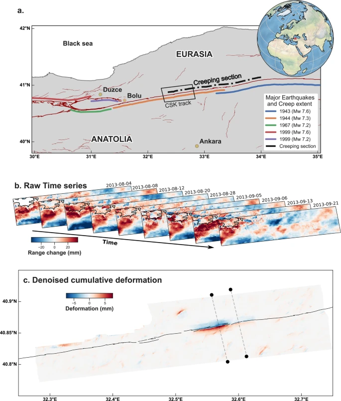
Application to real data: the North Anatolian Fault 2013 slow earthquake. Credit: Nature Communications volume 12, Article number: 6480 (2021)