Phys.org September 16, 2021
Existing technologies lack accuracy and ability to scale to effectively aid disaster relief and recovery. Even today, most wildfire event inspectors visit sites and manually classify building damage using before and after images of the buildings. A team of researchers in the US (Stanford University, California Polytechnic State University) has developed DamageMap, an artificial intelligence-powered post-wildfire building damage classifier. It is a binary classifier. Unlike existing solutions DamageMap relies on post-wildfire images alone by separating the segmentation and classification tasks. The model has an overall accuracy of 98% on the validation set (five wildfire events all around the world) and 92% and 98% on two independent test sets from the Camp Fire and the Carr Fire, respectively. DamageMap may help governmental and non-governmental agencies rapidly survey building damage using post-wildfire aerial or satellite imagery in wildfire-impacted areas…read more. Open Access TECHNICAL ARTICLE
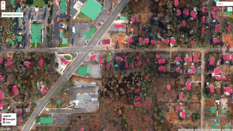
The DamageMap application identifies buildings as damaged in red or not damaged in green. Researchers developed the platform to provide immediate information about structural damage following wildfires. Credit: Galanis et al.