Asia Research October 1, 2020
Using convolutional neural network (CNN) a team of researchers in Japan trained an AI using post-disaster aerial images to accurately determine how battered the buildings are. It works by classifying buildings as collapsed, non-collapsed, or blue tarp-covered based on the seven damage scales (D0-D6) used in the 2016 Kumamoto earthquakes. Based on the photos used to train the AI, they found that the blue tarp-covered category predominantly represented D2-D3 levels of devastation. When the system was tested on post-disaster aerial images of the September 2019 typhoon that hit Chiba, results showed that damage levels of approximately 94% of buildings were correctly classified. They plan to develop a more robust damage identification method by using more training data obtained from disasters other such as landslides, tsunami, etc. The final goal of the study is the implementation of the technique to the real disaster situation...read more. Open Access TECHNICAL ARTICLE
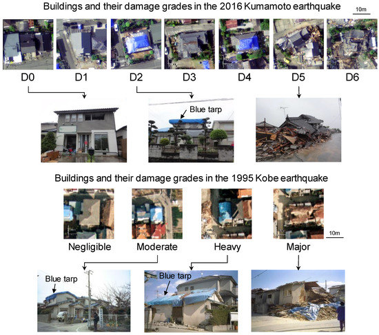
Close-ups of the typical buildings in the aerial images for each damage grade with ground photographs. The ground photographs of the 1995 Kobe earthquake are derived from the Nishinomiya database. Credit: Remote Sens. 2020, 12(12), 1924