Phys.org August 6, 2024
The continuous retrieval of clear-sky land surface temperature (LST) is important for monitoring vegetation temperature and assessing water stress conditions. However, the extensive cloud cover poses challenges in accurately forecasting LST in regions characterized by diverse vegetation types and complex terrains. Researchers in China proposed a synthetic aperture radar – and digital elevation model (DEM)-integrated LST reconstruction model (SDX-LST) to assess the practicality and robustness of the SDX-LST model. To test the model, they selected areas in America spanning a wide range of longitude and latitude and having obvious differences in topography, landforms, and vegetation. According to the researchers their model achieved excellent performance and high stability, and consistent predictions, and hence they concluded that their model enables precise predictions of LST for various vegetation types and intricate terrains… read more. Open Access TECHNICAL ARTICLE
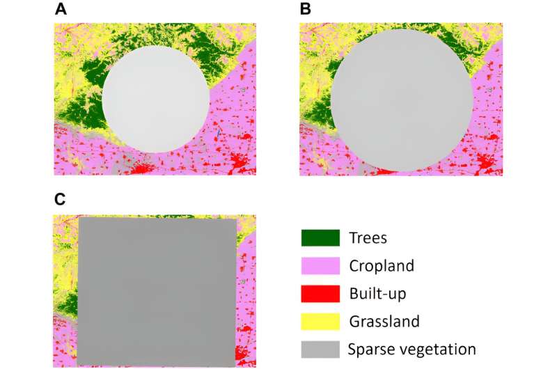
Three scales of LST deficiency for simulated cloud contamination… Credit: Journal of Remote Sensing, 26 Jun 2024, Vol 4, Article ID: 0071