Phys.org June 9, 2024
Researchers in the UK proposed a novel methodology for trustworthy autonomous multi-robot teams which incorporates data from multiple sources (HiRISE orbiter imaging, probability distribution maps, and on-board rover sensors) to find efficient exploration routes in Jezero crater. A map was generated, consisting of a 3D terrain model, traversability analysis, and probability distribution map of points of scientific interest. A three-stage mission planner generated an efficient route, which maximized the accumulated probability of identifying points of interest. A 4D RRT* algorithm was used to determine smooth, flat paths, and prioritized planning was used to coordinate a safe set of paths. The above methodology was shown to coordinate safe and efficient rover paths, which ensured the rovers remain within their nominal pitch and roll limits throughout operation… read more. Open Access TECHNICAL ARTICLE
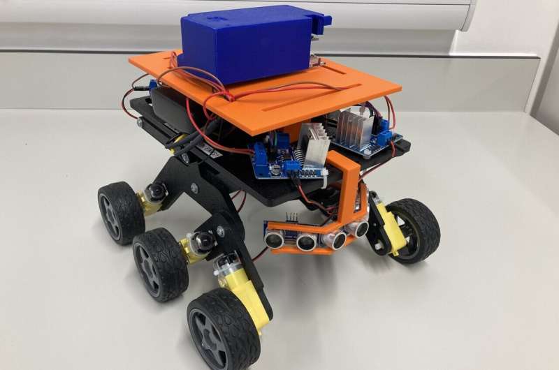
The rocker bogie runt rover has been selected as it has a small form factor and utilizes off the shelf components. Credit: Sarah Swinton.